Wyoming Geological Association
Where Geoscientists Come to Explore and Learn
WGA In-Person Luncheon ~ Tim & Karen Sue McCutcheon, Red Peak Resources ~ Topic: Interpretation of Subsurface Geology Using UAS Augmented Mapping
INTERPRETATION OF SUBSURFACE GEOLOGY USING UAS AUGMENTED MAPPING
McCutcheon, Timothy J.1, Karen Sue McCutcheon2, (1, 2) Red Peak Resources LLC, 254 North Center Street, Casper, Wyoming 82601.
Two case studies from Wyoming are presented to illustrate the use of low cost, Unmanned Aerial System (UAS) survey products to produce accurate structure contour maps. Products include high-resolution georeferenced 2D and 3D orthomosaic imagery and digital elevation models (DEMs). Structure contour maps generated from UAS survey data are used in the development of shallow depth oil and gas resources.
Smoky Gap oil field, discovered in 1956, has yielded nearly 900 KBO from numerous isolated fault/fracture reservoir compartments in the Upper Cretaceous Gammon Ferruginous Member of the Steele Shale and underlying Niobrara Formation at depths of 350 to 1,700 feet. A UAS survey covering 199.34 acres was acquired over a small portion of the field area. A total of 2226 geolocated images containing 60,059,511 key point observations were used to generate both 2D and 3D orthomosaics and DEMs at ~2.0 cm2 and ~15 cm resolution respectively. A surface geologic map and structure contour map were constructed utilizing these data. Quantitative information on fault zone geometry was obtained from DEM data and measurements on the ground. Structure contour maps on the Niobrara Formation “B” zone relied on projection of surface geologic structure into subsurface to identify fault/fracture drilling targets. Two test wells successfully intercepted anticipated fractured reservoirs but with unsatisfactory results, one well yielding 125 BWPD with traces of oil and the other testing 3-4 BOPD, ~80 MCFD and 60 BWPD.
Mule Creek oil field, discovered in 1919, has produced over 4.5 MMBO from shallow sandstone reservoirs in the Cretaceous Inyan Kara Group at average depths of 1,215 to 1,380 feet. After 103 years of operation production was averaging 29 BOPD at a 99.3% water cut. A UAS survey covering 1,415.46 acres (2.21 mi2) was acquired. A total of 7,480 geolocated images containing more than 130 million key point observations were used in generating a 2D georeferenced orthomosaic and DEM at ~2.6 cm2 and ~90 cm resolution respectively. The processed data were used to construct a detailed geologic and surface structure contour map utilizing marker horizons in the Upper Cretaceous Turner Sandy Member of the Carlile Shale. Subsurface structure maps on key horizons were then generated by subtraction of stratigraphic interval isopleths from the surface structure accounting for interpreted fault geometries. Four of eleven proposed well locations have been drilled to test potential bypassed reservoir compartments with favorable results. Two of the wells were completed at water cuts of less than 2%, with the remaining two wells testing at water cuts of 1.5% and 5-10% respectively. Maximum sustained rates of 64 BOPD were achieved in July 2024 with full year production averaging 50 BOPD, a 72% increase over pre-project rates.
Timothy J. McCutcheon, M.Sc.
Red Peak Resources LLC
Professional Geologist, Wyoming PG-919
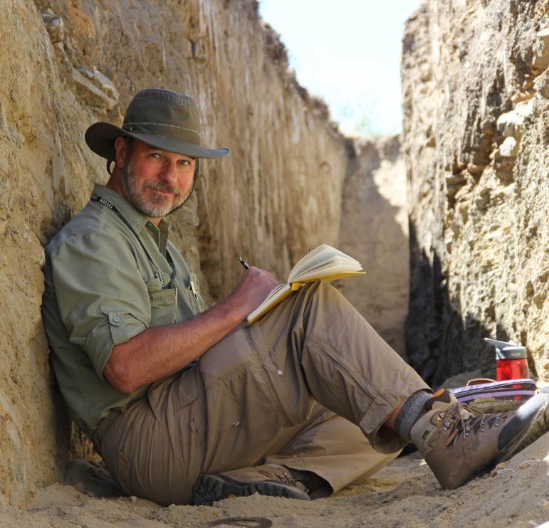
Tim is a licensed professional geologist with 46 years of experience in the exploration and development of crude oil, natural gas, and mineral resources. He is the Manager and co-owner of Red Peak Resources LLC and Manager of High Plains Mining LLC.
His experience and expertise are broad based, with an emphasis on the application of surface and subsurface mapping, petrography/petrology, geochemistry, petrophysics, and seismic methods to exploration and development problems. Past projects have included regional exploration and prospecting, basin analysis, reservoir studies, resource and reserve assessments, and property evaluations. He has also provided expert witness testimony for numerous regulatory hearings and on certain legal matters. His career has covered a diverse range of geologic settings, including: the greater Rocky Mountain Region; Williston Basin, North Dakota; Basin and Range, Nevada; western Brooks Range, Alaska; Chihuahua Mexico; north and east Africa; East Java Basin, Indonesia; and the South Turgay Basin in the central Asian Republic of Kazakhstan.
He was first employed as a part-time Field Assistant and Preparator for the Science Museum of Minnesota Department of Paleontology from 1973 -1977. From 1979-1981 he was employed in various temporary positions involved in uranium, base and precious metals exploration in Mexico and Alaska. In 1981 Tim joined Marathon Oil Company as an exploration geologist rising to Senior Geologist for International New Ventures in 1989. In 1993 he left Marathon Oil Company to work for Barlow & Haun Geologists before striking out on his own as an independent geologist in 1995. Since 1995 he has undertaken over 60 domestic and international projects for a wide range of industry clients.
Tim earned a Bachelor of Science geology degree from the University of Minnesota, Duluth (1979) and a Master of Science Degree in geology/geophysics from University of Texas, El Paso (1982). He obtained additional corporate sponsored post graduate education through the Coastal Studies Institute, Louisiana State University (1982), the Comparative Sedimentology Laboratory, Rosentiel School of Marine and Atmospheric Science at the University of Miami, Florida (1988), and the Marathon Denver Research Center (1982-1991). Throughout his career Tim has continued his education through participation in numerous field and classroom courses sponsored by AAPG and other professional organizations.
Tim is a member and past President of the Wyoming Geological Association (WGA), a Geological Society of America Fellow, and member of the American Association of Petroleum Geologists and the Society of Economic Geologists. He has authored or coauthored several scientific papers on the subjects relating to petroleum and economic geology. From 1996 to 2005 he served as a member of the Potential Gas Committee, Colorado School of Mines. He is a 2012 recipient of the Frank A. Morgan Sr. Memorial Award for Meritorious Achievement from the WGA. Community activities include participation in industry-school partnerships to promote K-12 science education in Houston, Texas and elementary through middle school classroom enrichment experiences and field trips for Natrona County Schools.
Karen Sue McCutcheon, M.Ed.
Red Peak Resources LLC
GIS Specialist/FAA Licensed UAV Pilot
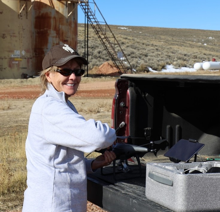
Karen Sue is co-owner of Red Peak Resources LLC, a certified Geographic Information Systems Specialist and licensed FAA Part 107 remote pilot. She has 15 years of experience in natural resource exploration and development. Her technical areas of expertise include GPS data gathering and data reduction, unmanned aerial systems data acquisition and mapping, computer-aided geo-reference and geospatial data analysis, integration of satellite and aerial imagery, and other data to build databases, construct maps, exhibits, and diagrams used in the analysis and interpretation of surface and subsurface environments.
Her work has included acquisition and processing of high-resolution UAS surveys, data processing and mapping for petroleum and mineral resources in Wyoming. She has also completed several UAV surveys for renewable energy and agricultural projects located in Wyoming and Nebraska. She has prepared geospatial databases for a variety of projects, constructed and maintained land ownership maps for clients and created numerous geotechnical exhibits used in regulatory hearings and other legal proceedings.
Karen Sue has a Bachelor of Arts degree in Elementary Education from Kearney State College, Nebraska and a Masters of Education from Colorado State University, Colorado. She obtained her GIS Certification from Casper College, Wyoming, and additional training through ERSI, Stanford University, and LMKR Geographix.
Her career as an educator working for Natrona County School District No.1 spanned 32 years with emphasis on development and integration of innovative technologies into the classroom. As an award-winning educator, she not only taught in the classroom but also provided professional development training to district teachers and staff, graduate level classes through the University of Phoenix and internationally as an Instructional Facilitator for PBS. From 2011 to 2019 she served as an adjunct instructor for the Earth Sciences program at Casper College before retiring from education.
In 2007 Karen Sue received her National Board Certification, the highest, most respected education certification attained by fewer than 5% of teachers in the USA. She is a recipient of the Presidential Award for Excellence in math and science education (1996) and the Ellbogen Meritorious Educator Award (2015). She is a former member of WyGEO and from 2013-2014 served as the GIS representative on the Wyoming State Geographic Alliance Steering Committee. She has been a Master Gardener since 2013 and actively participates in providing horticultural information to the Casper, Wyoming community.
Event Information
| Event Date | 10-10-2025 11:15 am - 1:00 pm |
| Capacity | 40 |
| Individual Price | $25.00 |
| Location | Racca's Pizzeria Napoletana |
Find Out What's Happening at WGA
View current and archived issues of "Contact" the Wyoming Geological Association Newsletter.


WGA Sponsors
Thanks to all our valuable WGA Sponsors! Are you interested in advertising with WGA. Learn how.
Website Design by Waves Web Design.